CASEarth DataBank System Development
Overall achievements
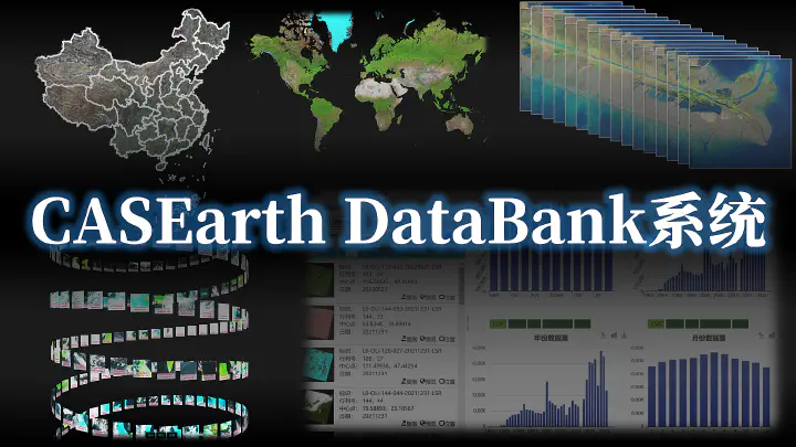
We completed the CASEarth DataBank system, integrating data, computing, and services. We also built a multi-source satellite data processing and integration service supporting on-demand processing of 18 types of remote-sensing data products, and a quality inspection system supporting 22 types of domestic and international Earth observation satellite data and products. The long-term Landsat RTU collection covers China and surrounding areas from the 1980s onward. It includes 12 products: surface reflectance, land-surface temperature, top-of-atmosphere reflectance, at-satellite brightness temperature, NDVI, EVI, MSAVI, SAVI, NDWI, NDMI, NBR, and FVC, with approximately 645,000 scenes and 7.74 million data products overall. We produced 14 global 30 m map editions for the 1980s, 1985s, 1990s, 1995s, 2000s, 2005s, 2010s, 2011s, 2013s, 2015s, 2017s, 2018s, 2019s, and 2021s, as well as six nationwide 2 m map editions for 2016s, 2018s, 2019s, 2020s, 2021s, and 2022s. Products at resolutions down to sub-meter scale were supplied for selected areas according to project and external requirements. Data submission has been completed in accordance with CAS scientific data management requirements and the project’s data-sharing arrangements, with a total volume of approximately 2.9 PB.
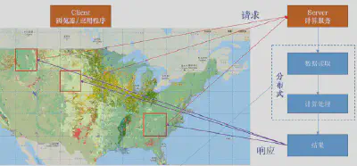
CASEarth DataBank platform
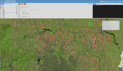
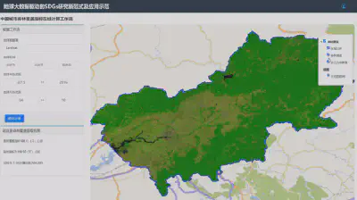
Long-term multi-source Earth observation RTU products
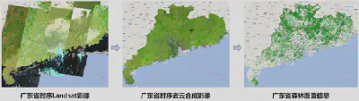
(1) Long-term Landsat RTU products for China and surrounding areas
These products have been used by more than 30 research institutes, universities, and application organizations. Users include the CAS Institute of Tibetan Plateau Research, Institute of Botany, Institute of Geographic Sciences and Natural Resources Research, Xinjiang Institute of Ecology and Geography, Research Center for Eco-Environmental Sciences, and Institute of Mountain Hazards and Environment; Tsinghua University, Peking University, Fudan University, Wuhan University, Shenzhen University, and China University of Geosciences; France’s ENSAS school of architecture; the Research Institute of Forest Resource Information Techniques of the Chinese Academy of Forestry; and Sungrow Renewables. Applications span agriculture, forestry, land resources, ecology and the environment, and energy.
(2) Multi-source high-resolution RTU products
The nationwide 2 m map supports demonstrations of the Digital Earth science platform. Products for selected areas at resolutions down to sub-meter scale have supported platform demonstrations and SDG demonstration zones in Hainan and Lincang.
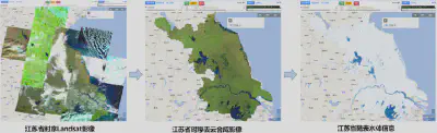
(3) Global thematic products at 30 m resolution
The global 30 m land-surface water product was incorporated into the Global Water Resources Data Products collection of the International Research Center of Big Data for Sustainable Development and released internationally in March 2023. It supports monitoring and assessment of water-related Sustainable Development Goals, including SDG 6.6, SDG 11, SDG 13, and SDG 15, and contributes to sustainable water resource management. CASEarth DataBank provides bulk download, online visualization, and other services to make the global product easier to share and use.
Forest cover research was included in both the 2020 and 2021 editions of the Big Earth Data in Support of the Sustainable Development Goals reports, edited by Academician Huadong Guo and published in Chinese and English. The forest product was selected as an SDG public data product. Its research case was exhibited at the International Forum on Big Data for Sustainable Development and featured on the SDG big data platform homepage, where on-demand production of SDG 15.1.1 forest cover data and assessment of forest coverage were implemented.
To support China’s science diplomacy, the 2020 global 30 m forest cover product was included in the BRICS Sustainable Development Data Products collection at the BRICS Forum on Big Data for Sustainable Development, held in Beijing on April 26–27, 2022. It supported Xinhua’s news video on viewing BRICS from space and was released as a core output. In October 2022, the global 30 m forest cover product was again selected for the global sustainable development data products presented by CBAS to the United Nations, and was presented by State Councilor and Foreign Minister Wang Yi.
Burned area research cases were included in the 2020 and 2021 editions of the Big Earth Data in Support of the Sustainable Development Goals reports in Chinese and English. They were exhibited at the CAS exhibition on Big Earth Data for monitoring and assessing the SDGs, organized with the SDG center and other partners to mark the 50th anniversary of the restoration of the People’s Republic of China’s lawful seat in the United Nations. At the request of the Ministry of Foreign Affairs, we submitted a report on high-resolution monitoring of burned area changes in Australia (2005–2019), based on the long-term 30 m burned area product, to support relevant decisions with data and information.
At the ministerial meeting of the Group of Friends of the Global Development Initiative on September 20, 2022, State Councilor and Foreign Minister Wang Yi presented the burned area product to the United Nations to support countries in achieving the SDGs. The product was also included in the UN Biodiversity Lab (UNBL) data-sharing platform.