Remote-sensing Big Data Engineering and Applications
Research
Computer VisionCross-disciplinary (From Earth to Eye)Remote SensingRemote-sensing RTU Products and ServicesIntelligent Remote-sensing Data Processing and Information MiningRemote-sensing Big Data Engineering and ApplicationsRemote Sensing for Human Well-being1. Rapid generation of global remote-sensing products
(1) Fast, high-accuracy global 30 m burned area mapping
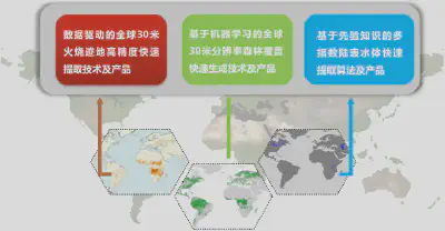
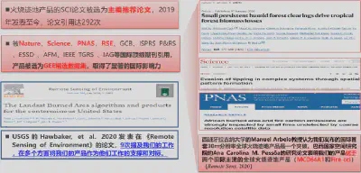
We developed an original algorithm combining multi-source sensitive variables and machine learning for fast, high-accuracy global burned area mapping at 30 m resolution, producing the world’s first and only global 30 m burned area product for 1990–2024. It is currently the highest-resolution global burned area product. The work has produced 11 papers in journals including ISPRS P&RS and Earth’s Future, with citations from Nature, Science, and PNAS. The product has supported studies published in Nature and other journals and was presented to the United Nations by Foreign Minister Wang Yi.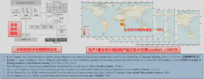
(2) Machine-learning methods for rapid generation of global 30 m forest cover products
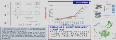
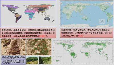
Combining global ecosystem zones, crowdsourced samples, and machine learning, we developed a rapid processing method for global 30 m forest cover products and established automated, continuous production. We released global 30 m forest cover products with the longest time span and highest timeliness currently available. We also mapped forests across China using domestic satellite imagery at 16 m resolution.
(3) Rapid generation of land-surface water products using prior knowledge
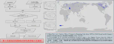
We developed a rapid land-surface water extraction method based on prior knowledge. Multiple indices exclude interfering factors, while prior knowledge guides water extraction, reducing the need for manually selected samples and increasing automation. Using available multi-temporal imagery from the target year improves the reliability of the results. Overall accuracy is 90.6%.
2. Intelligent services for multi-source ready-to-use remote-sensing information
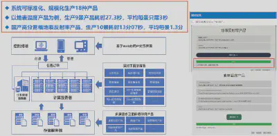
(1) Processing and integration of multi-source satellite RTU products
(2) CASEarth DataBank intelligent services
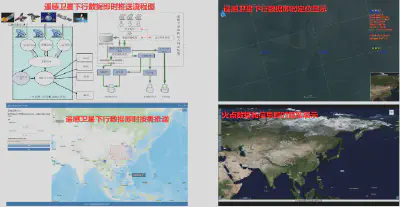
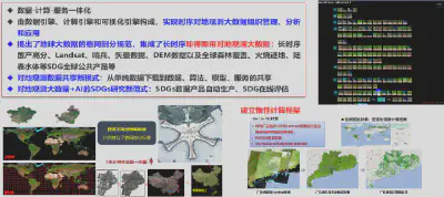
Supported by the China Remote Sensing Satellite Ground Station, a national major scientific facility, and developed with the Computer Network Information Center, Institute of Software, and Institute of Computing Technology of CAS, the system combines the ground station’s data acquisition capabilities and archives with other Earth observation data. Data integration and standardization produce long-term, multi-source RTU satellite datasets that provide reliable, stable, and continuously updated data for Big Earth Data science, with tiered services and sharing.
The independently developed CASEarth DataBank system integrates data, computing, and services into an intelligent platform for long-term Earth observation data. It incorporates general AI methods and application-specific algorithms, using lazy computation for near-real-time cloud processing of large data volumes. This addresses difficulties in downloading Earth observation data, the specialist knowledge needed for processing, and inefficient analysis. The platform has supported a series of Sustainable Development Goals (SDGs) studies and established a new approach to SDG research driven by Big Earth Data. It combines expertise across disciplines and provides a complete chain from data to computing and services, offering a powerful and accessible scientific experimentation platform. It supports efficient transformation of Big Earth Data into spatial information and geoscientific knowledge, interdisciplinary work in AI and remote-sensing processing, knowledge discovery, and scientific innovation.
(3) Immediate services for multi-satellite downlink data